This article is from WeChat public account:Netease Airways (ID:wyair163), author: ground calm winds, from the cover of the original
Imagine that you came back on vacation one night, the plane was flying in the South Pacific, and suddenly heard the captain broadcast while enjoying the dinner on board: “Girls, gentlemen, there is a plane in the vicinity lost due to equipment failure. We are the only ones that can provide rescue flights, so we will try to find it.”
You might think: “Looking for a small plane with a big plane, is it possible?”
But this magical thing happened on NZ103 flight from Fiji to Auckland, New Zealand on December 22, 1978.
Today we will tell this story.

The flight of NZ103 is a DC-10 aircraft
The beginning of the story begins with the buddy of the trek.
The trekking aircraft is a Cessna 188 aircraft, which is probably as long as the picture below, also known as the capitalist agricultural machine (because it is widely used Sprinkle pesticides, sowing, etc.).

Data Sheet: Cessna 188
So why is such a small plane appearing over the vast Pacific Ocean?
As we all know, Cessna is a small aircraft manufacturer in the United States, and the purchaser of this aircraft is located in Australia, so after the buyer took the plane, the seller began to arrange delivery.
Although it was a small plane, the container could not be loaded. As for the disassembly, it was shipped to Australia for reassembly, which was a bit difficult for the buyer. Then you can only find someone to fly the plane all the way.
Of course, it is impossible for Cessna 188 to fly straight. From the United States to Australia, only the island can fly.
The mission of flying is a pilot named Jay Procino 
Pago Pago, the capital of American Samoa
Norfolk Island, a territory outside Australia
When flying, Cessna 188’s navigation method is mainly through the onboard automatic orientation instrument (ADF) receiving near Norfolk Island Non-directional wireless beacon (NDB) signal.
But after flying a few hours over the innocent South Pacific as directed by the ADF, it should have arrived at the destination, but the pilot found that the expected island did not appear in sight.
In the beginning, Jay didn’t realize how dangerous this was. He initially thought that the air was getting bigger and the speed of the plane was a bit small. He might have to wait a little longer to see his destination; As an experienced former naval retired pilot, he set out to check his own airborne equipment, especially the core equipment of navigation, the ADF. This check really scared Jay out of a cold sweat, because the ADF did not know when it was broken.
That is, this Cessna, lost in the South Pacific. Without a pilot signal, this small plane is like a headless fly that turns around in the Pacific Ocean.
But it’s good to say that the controllers that say “The Earth doesn’t explode, we don’t have a holiday” are always online, Jay via HF communication(HF) An emergency was announced to the Oceanic Air Traffic Control Center. When an emergency was announced, it was estimated that Jay’s heart was desperate. After all, in the case of navigation equipment failure, he did not know where he was. The only thing he could count on was luck enough to meet a wide enough. The island was used to make a forced landing.
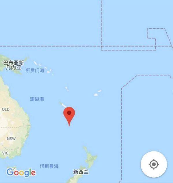
At this point, we returned to the scene at the beginning of our article, when the Fiji-Auckland flight was being carried out, and the NZ103 flight with 88 passengers happened to pass by.
When the NZ103 crew heard the news, they immediately realized that if they did not give a helping hand, they would only have to wait for Jay. After all, the sky will be dark at the time, no matter whether the outcome of the night is forced to land or the discovery of other islands is very unlikely, even if the subsequent search and rescue team is destined to get nothing in the dark.
Captain Gordon, after explaining to passengers the reasons for the yaw and delay of landing, began to think about how to find the lost Cessna 188 in the fastest way.
Although Gordon was a navigator, he didn’t even think of a good idea at first, but at this time the cockpit door was knocked out. There was another navigator returning from the passengers. After the captain broadcasted, he volunteered to join the brainstorming of the cockpit.
They needed to realize that the two planes successfully merged on the sea with only radio communication. (At that time, satellite communication positioning was not popularized in civil aviation)
In thinking, Gordon realized that a great method was in front of him. At that time, it was just in the evening, and the relative position of the two machines could be solved by combining the sunset point angles of different positions with the sunset time difference.
Gordon contacted Jay by radio, explained his method to him and asked him to point the nose at the sunset to report the heading reading on the compass. At the same time, Gordon also asked his co-pilot Arthur 
Adapting the movie “Mercy Mission” poster for this event
So everyone took a sigh of relief, this DC-10 then sailed southwest, about 25 minutes later, the two machines can be in the short distance of the very high frequency (VHF)Contact the other party on the radio. Of course, although the distance of this VHF is relatively short, there is also a communication range of nearly 200 nautical miles. How to avoid the two machines passing over the lack of reference oceans has become a problem.
However, aviation engineer Gordon (modified, this The maximum airtime of the Cessna aircraft was 22 hours, and Jay saved part of the fuel by economic cruising).
There is no doubt that without the companionship and help of the DC-10 from start to finish, it is difficult for Jay Procino to stand alone to see the offshore drilling platform. This is also the case after the McDonnell Douglas AwardAs mentioned in the NZ103 crew, in recognition of the “highest standards of compassion, determination and aviation spirit” demonstrated by the NZ103 crew.
This article is from WeChat public account:Netease Airways (ID:wyair163), author: ground static wind