In the era when map software has not yet appeared, taxi drivers are the smartest city brain. They are familiar with how to turn left and turn into a road with less cars. It is also clear that going to the east during this time will definitely encounter traffic jams.
After the local map software appears, everyone can get the fastest route to the destination in real time. According to a 2015 survey by Pew, 90% of Americans with smartphones get navigation information from map software to find faster routes.
But we didn’t think that the map software is making the city as a whole more congested while it brings convenience.
City Lab recently wrote an article < /a> A systematic analysis of this issue by SOM (Skidmore, Owings & Merrill LLP), one of the world’s largest architecture, interior design, engineering and urban planning firms.
In the world’s first “blocking city” in Los Angeles, residents in the peak hours traffic congestion per year 102 hours; If you are not busy,, 2016 The average annual consumption of traffic jams is 80 hours.
Navigation software Waze can be said to be the dawn of many citizens.
This software, launched in 2009, includes a variety of real-time messages from users in addition to regular road conditions, such as where there are shortcuts, which roads have police cars or road repairs.
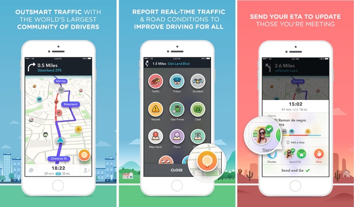
▲ Waze, the picture comes fromHBS
Brian Roberts, author of a book on Los Angeles’s transportation shortcuts in the 1980s, said in a 2015 review article that Waze is “a quantum breakthrough for those of us who want to maintain normal blood pressure during commuting.” .
The problem is that the more useful Waze is for users, the worse the traffic will be.
You and I save five minutes, the city life is even worse
For many years, research scholars have agreed that most of the “personal driver-first” transportation options are counterproductive. For example, when you find that the traffic in a place is very large, the government has widened the road and thought it would make everyone more comfortable, but the result is still the same:
The traffic we usually see does not represent the true peak of the peak period, because the traffic jam itself allows many people to take the initiative to reschedule or change lanes.
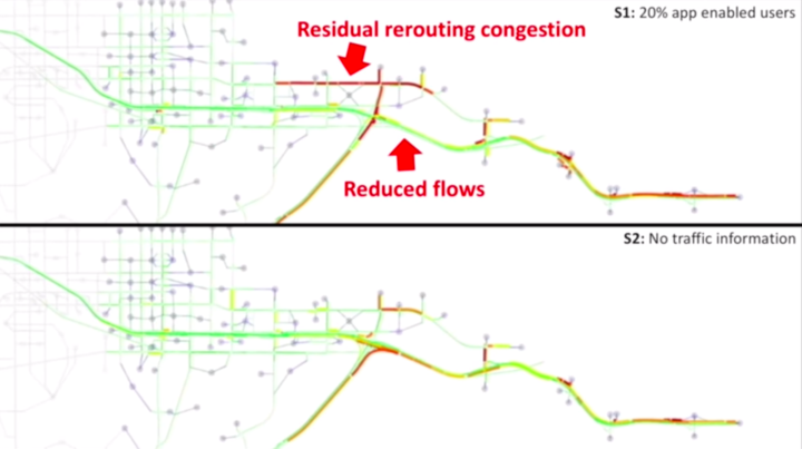
At the Cal Future Forum in 2017, Alexandre Bayen, director of the Transportation Research Institute at the University of California at Berkeley, shared a computer model with the audience to simulate how people deal with traffic accidents on the highway.
Bayen said that on this road, as long as 20% of drivers use navigation software, the overall time spent on all drivers on the road will increase. Because of the navigation software recommendations, the drivers wanted to take the path to avoid the affected roads, and the roads could not carry such a large amount of traffic in the design. As a result, the cars were blocked and the chain reaction affected the roads behind them.
 Washington Post
City Lab author Laura Bliss himself experienced this change. She lives in Sherman Oaks, a relatively high-end residential area in Los Angeles. The driver has chosen to walk away from San Fernando Valley in order to bypass one of the county’s most congested main roads, the I-495.
I grew up there and witnessed it all: at 8:00 am on weekdays, the noisy road was full of cars on the road, and the drivers above were also anxious.
The city government’s survey also found that traffic conditions have deteriorated in recent years, in part because of the navigation app. Under the opposition of the residents of Sherman Oaks, the city began to set a speed-down sign and traffic restrictions on the road, which is basically to pray for others not to take the road in front of their home by making the traffic situation in their own area worse. It doesn’t help.

▲ Homemade roadblocks, pictures from USA Today
Now, the Los Angeles Department of Transportation is even asking for Waze, Google Maps, and Apple Maps, and has trouble striping parts of Sherman Oaks from their maps.
The Bay Area residents who are also suffering from traffic jams due to navigation apps choose to do it themselves.
They started to open various navigation apps near their homes to report non-existing car accidents. Someone opened the navigation and walked to the road, pretending to be a car in a traffic jam, attempting to create fake data and affecting the map algorithm.
In the suburbs of cities such as Washington, Boston, Toronto, and Paris, residents have established self-made diversion signs or initiated parades.
How should traffic be changed?
SOM believes that when redesigning traffic, the city should first think about what it is trying to solve.
The goal of most urban transport in the 20th century was to get the shortest travel time at a certain distance, and that didn’t seem to work. Perhaps it is time to consider setting the goal of “sending as many people as possible to schools, offices and shopping centers” for overall optimization.
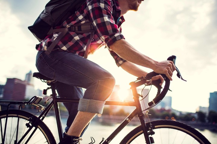
Or, when you are planning a city, you will design these “destination” and places where people live, so that more people can choose to walk or cycle. One of the reasons for congestion in Los Angeles is its uneven distribution of business districts. Residents living in the city center, if they think of the prosperous shopping area, at least a dozen kilometers drive.
However, the navigation app that has emerged in the last decade can help alleviate traffic congestion without changing traffic planning, but it requires data convergence between different software and transportation departments to calculate an overall optimized solution. To divert traffic. The problem is that it’s not easy to get the most valuable data from a business navigation app that is fundamentally competitive.
Before traffic gets better, most people can only continue to use self-interested navigation software to reduce commuting time.
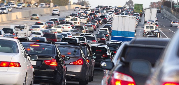
The title map is from Bedford Independent< /p>